After my goodbyes to Juan and his wonderful family, it was time for me to set out on my second set of goals for the trip south. I wanted to visit as many Mayan ruins as possible. I have been intrigued with the Mayan story, and each time that I visit one of their sites, I feel that I have learned a bit more about their culture and that I have a better understanding of this part of History.
I headed south and east from San Juan La Laguna, retracing my trips over the mountain roads, accompanied by police for the initial ride near the Lake around San Pedro, and soon I was on my own again. I spent a night in Antigua, filled with tourists enjoying this wonderful town. It was interesting to be back, as I had attempted to learn Spanish there, six years previously. After a couple of days of riding, including getting completely turned around in Guatemala City and ending up literally on the wrong side of the tracks in a section of town populated by hookers and cops in equal numbers, I managed to reach Tikal.
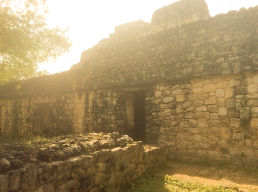
Tikal is located in the area of the Peten Basin, in northern Guatemala. It is now a World Heritage Site. In its day, Tikal was the capital city of one of the most powerful kingdoms of the Maya. During its heyday, in the Classic Period from 200 to 900 AD, the city interacted with other parts of MesoAmerica, all the way north to Teotihuacan, just north of present day Mexico City, and to the present day Honduran site at Copan, to the south.
Tikal is the fairly recent name for this ancient city, given to it by its "discovery" in 1840. Originally, the Mayans may have referred to this huge site as "Tax Mutal". Archaeologists have mapped the entire site and they have determined that there are more than 3,000 structures hidden within the area designated a\s the Tikal National Park.
An interesting aspect of the site is that Tikal had no water sources, other than what was collected from rainwater and stored in the ten reservoirs which were built for that purpose.
Upon entering the park, the road signs warn tourists of the locals animals and that it would not be a good idea to hit one on one's motorcycle...

Huge trees within the park include gigantic Kapok (Ceiba), the sacred tree of the Maya, tropical cedars and Honduras Mahogany.
While I did see the Howler Monkeys, the white-nosed coatis, grey foxes, harpy eagles and ocellated turkeys eluded me. While I was camping, I could hear the Howlers off in the jungle and as they moved through the trees, across the night sky.
I am fascinated with the Mayan architecture, as they reached for the Heavens, climbing beyond the reach of the jungle and into the blue skies.
For Star Wars fans, it worth noting that George Lucas used Tikal as a filming location for "...the first-released Star Wars film, Episode IV: A New Hope, which premiered in 1977."
Temple II
Temple II
Temple II- "also known as the Temple of the Mask, was built around 700 AD and stands 38 meters high.
Temple IV
This temple is the tallest temple-pyramid at Tikal, measuring 70 meters from the plaza floor level to the top of the roof. "..It currently stands is the the tallest pre-Columbian structure in the Americas although the Pyramid of the Sun at Teotihuacan may originally have been taller..."
According to sources, there are "thousands of ancient structures at Tikal and only a fraction of these have been excavated, after decades of archaeological work". Some of the surviving pyramids at Tikal are over 60 meters (200 feet) high.
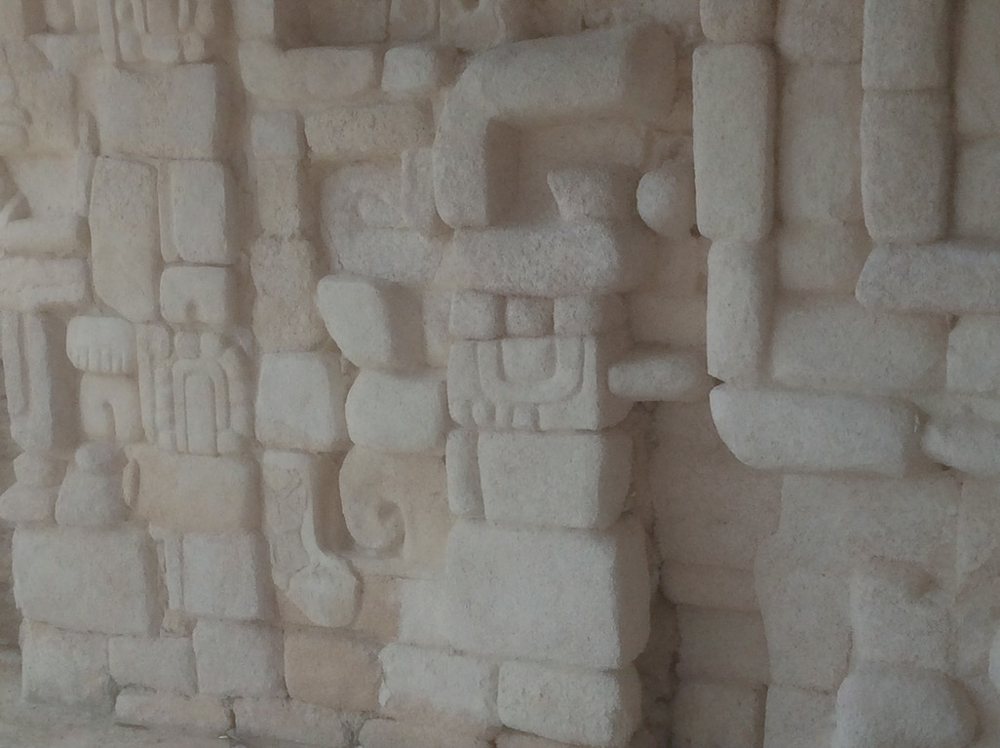
Stelae are carved stone shafts, often sculpted with figures and hieroglyphs.
Scholars have completed rigorous studies of the the glyphs and stelae of Tikal and other Mayan sites. The history of the Mayans and the region is general is well-documented and has afforded many a Phd for aspiring archaeologists and linguists. I am fascinated to read about Mayan rulers with such wonderful names as "Great Jaguar Paw", or "Spearthrower Owl". My youthful reading of National Geographic has finally paid off as I view these wonderful inscriptions and speculate about the tales they tell.


In the "Terminal Classic" period of MesoAmerican history, around 950 AD, "Tikal was all but deserted...and the rainforest claimed the ruins for the next thousand years." I struggle to understand and appreciate these facts. Nowhere in my realm, except for Yuquot and newly discovered sites south of Waglisla, have people lived over a thousand or fifteen hundred years ago. Clearly I need to get out more, but this idea of a thousand years of stillness in the jungles is intriguing and inspiring at the same time.
I camped within the Park, and spent most of the night listening to the sounds of the Jungle. The night sky was filled with unfamiliar constellations, and the jungle trees seemed to reach into the Heavens. I could only imagine the stories that the Mayan Spirits could tell if I knew how to hear them. Over half a million souls lived in and around Tikal..what do their Spirits have to say to us?
Tikal to Belize to Quintana Roo...
Upon leaving Tikal, I headed eastward, towards Belize. This was going to be my first time in Belize. Maps can tell you one thing about a country, and certainly the Internet has all sorts of different stories about each country as well. I really did not have any preconceptions, other than I knew that English was spoken and that it would mean another money exchange.
The border crossing was more or less straightforward, and certainly not having to deal with another language helped expedite the process. Even the money exchange was more or less civil, and I felt that the fellow that I worked with was fair. My biggest mistake was in conversation with the Aduna for the Belize government. Now I may be putting out the wrong vibes to middle-aged women, but my somewhat one-sided conversation, albeit in English, ended up with me having only two days to get through Belize. When asked the purpose of my visit, I had mentioned that I was travelling north to Mexico. Whether she assumed that I did not want to stay in her country, or she did not cotton to old biker guys, she told me that I could do that in two days. Clearly my body language and lack of protestations did not help to resolve the issue, and two days is what was stamped onto my entry visa.
While I had my GPS systems, and my maps, I did not have a real sense of the length of Belize, in terms of travel.
Not being the kind of guy to make waves in foreign countries, as I have learned from my misspent youth, I dutifully set out to travel northward and to keep the Belizian authorities happy. I had read enough negative reports about Belize City that I did not plan on stopping there and risking having my ride stolen. Belize City is probably very beautiful and the people are more than likely very cool, but I had my riding directions, so I headed north.
I spent one night in a sleepy little town north of Orange Walk, realizing that I had ridden the length of the whole country in less than a day. I knew that there were Mayan ruins nearby, and I had been advised by an ex-pat Canadian that I could go to the local Aduna and have my visa extended, if I wanted to. I decided to forgo the Belizian ruins for another visit, and headed north into Mexico.
Over the past few years, I have undertaken dozens of border crossings, and I have never been turned around or refused entry on my travels. Having said that, there is a nervousness and anxiety that I have learned to associate with this process. It is silly, and possibly causes much more anxiety for me than is necessary. From what I recall the reentry into Mexico was without issue, except that I dropped the Twin twice within 30 seconds.
The authorities at most borders have a fumigation process that is designed to clean your vehicle of bugs and other contaminants that one may be introducing into their country. If I remember correctly, it was at this border crossing into Mexico where there was not a single hand-held sprayer, but a full-blown bay for vehicles. The border people directed me into the bay, and fortunately, had the good sense to use a handheld sprayer on the Twin. When I was fumigated, I attempted to leave the bay, and quickly and loudly spun out and layed the bike down, accompanied by lots of English swears.
I was not hurt, but tired and angry and the very slippery state that the fumigation fluids had left all over the concrete bay. The guys were quick to help me lift my overladed Twin up and to get me steadied. My second attempt to leave the fumigation bay resulted in the exact same results: I was flat on my ass, the bike was down, and I was still swearing profusely. Fortunately, the second lay down had put me close enough to the exit of the fumigation bay that on the third attempt to leave, I was able to gain some dry surface and putter off, leaving the guys looking at each other and probably muttering something about loco gringoes. It is those kinds of incidents when I need to have my Go-Pro skills much improved, as I am sure that my armchair follower would get a kick out of my use of the English language...
I arrived in Chetumal, a thriving Mexican city, and found a decent room for the night. I planned my route into the interior, and learned that I had survived a Tsunami off the coast of Belize the night before. From my walkabout along the coast, I thought the Caribbean to be very pretty and calm, and very inviting.


My general plan, now that I was in Quintana Roo, was to visit as many Mayan ruins as possible. I found that by heading westward, I would soon be right in the midst of many Archaeological Zones. My challenge would be to figure out the road systems and to target those sites. The states of Quintana Roo and Yucatan have very good highways crisscrossing the territories. They also have many, many side roads and less-travelled byways that criss-cross the region. The area is as flat as Alberta, and in spite of many years of ranting at students about "Never Eating Soggy Wieners" I am seriously directionally challenged when I don't have a mountain range to guide me.
Dzibanche
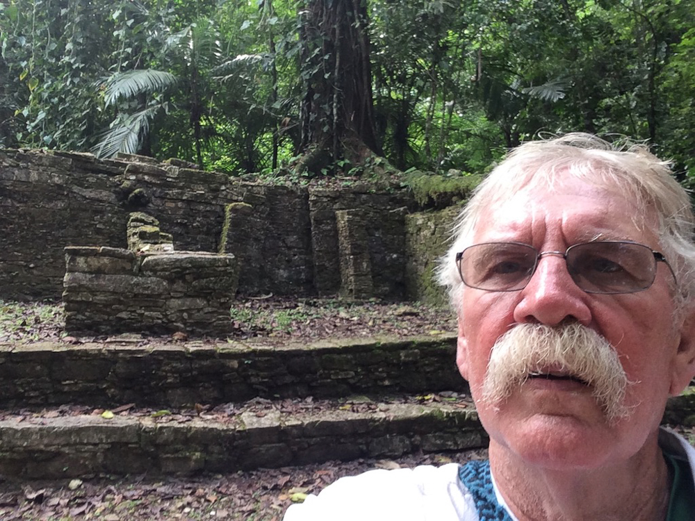
Thanks to the good road and highway system out of Chetumal, it was not too difficult to find the two sites that were in the immediate area. Dzibanche and Kinichna were close to one another, and as I quickly found out, not nearly as populated with entrepreneurs and tourists. I arrived at one site and had it completely to myself, after a brief conversation with the guard. After the immensity of Tikal, I was pleased to see that these sites were somewhat less developed and that I was free to wander anywhere that I wished, climbing the ruins and sticking my nose into nooks and crannies.
It is a spiritual experience for me, to stand atop of a Pre-Columbian artifact and to scan the level flatness of the region for kilometres and kilometres around. The blue skies simply compound the effect of the jungle and the music of the birds and animals.
The builders had a different style of developing their pyramids, with more exposed rocks, and kind of a "stepped" process to getting to the Sky.
When you can see trees silently climbing up the stairs to Heaven, you know that you are looking at something very old, and very powerful.
The afternoon sunlight and the quiet breathing of the surroundings contributed to the spiritual feeling of these sites.
I wondered what kind of wood was used for the lintels of these doorways, in that they have survived for thousands of years.
Each of the artifacts attempts to climb out of the flatness of the jungle plain, and reach for the skies. For kilometres and kilometres, there is not a break in the horizon, except for another mound, which in all likelihood is another Mayan site.
A different style of construction, while still using the local limestone, the blocks are more rough-hewn in some cases.
What was that story, where the Giant Ents moved throughout the world?
I marvel at the time, patience and skills that the archaeologists and other specialists must have in order to uncover and protect the amazing glyphs and inscription which are found throughout these sites.
While very much away from the traditional tourist paths, these two sites were exceptional in that they demonstrated the willingness of scientists and politicians to make the effort and find the resources to discover and to preserve these wonderful remnants of days gone by.
As I mentioned earlier, the flat territory of Quintana Roo and Yucatan frequently had me going in circles. Compounded with an interesting system of signage for their highways, I sometimes found myself lost and confused more than usual. I frequently turned on my compass on my GPS, as I knew that this road or that track would take me in the direction that I needed to go. I think that the map below reflects my path towards my next goal, which was Ek Balam, and then on to Chichen Itza. I had gone to Chichen Itza with my two sons a number of years ago, and while I knew the area to be accessed by many tourists, I still wanted to renew my acquaintance with what to me is one of the wonders of the modern and ancient world.
In an ideal world, one where I understood HTML coding, the blog would follow the natural path of events. In other words, dear reader, you should expect to see the sight of the wonderful site of Ek Balam. I believe that in my initial outline for this particular posting I set up an intenerary that was almost as confusing as my navigating in the Yucatan itself. Rest assured, that I did in fact visit Ek Balam before I journeyed to Chichen Itza, which would make sense on so many levels, except when you are manipulating html code, photos, and cranky hard drives. Hopefully my grandson(s) will understand better than I. Onward...
Chichen Itza
Since my last visit to Chichen Itza, there seemed to be more folks selling their wares. I had to look long and hard to see something that was authentically made locally. I am afraid Chinese-made junk does not reflect the best values of the Mayans, and should not be a reflection of their descendants.


The remains of a feathered serpent, of which there are many here.
I noticed that the size and construction of the limestone blocks were different than those of the sites prior.
Another feathered serpent looking out towards El Castillo, the pyramid which dominates the centre of the site.
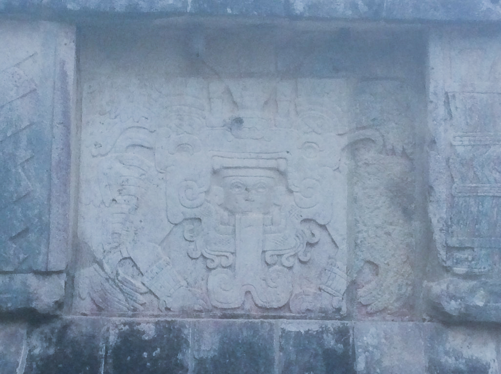
The rain god of the Mayans...
The intricate carving depicts a jaguar..
I am very happy with this photo. I caught the light and El Castillo at the right time in Space. While not during the ascending snake period of the Equinoxes, I could easily imagine the throngs of people gathered to watch ..."on the Spring and Autumn equinoxes, in the late afternoon, the northwest corner of the pyramid casts a series of triangular shades against the western balustrade on the north side that evokes the appearance of a serpent wriggling down the staircase, which some scholars have suggested is a representation of the feathered-serpent god Kukulkan."
This soldier has just lost on the ball court, and snakes are exploding from him...
What an amazing feature, this step pyramid, known as El Castillo, or the Temple of Kukulkan. It is 30 meters high, and has 9 square terraces. In the mid 1930's, the Mexican government sponsored an excavation of El Castillo, and they discovered a staircase under the north side of the pyramid, which led to another pyramid below the current one. Inside the temple chamber was a Chat Pool statue and a throne in the shape of a Jaguar, painted red and with spots made of inlaid jade.
The ball court is breathtaking in size. While "archaeologists have identified thirteen ballcourst for playing the Mesoamerican ballgame in Chichen Itza, ...the Great Ball Court (is) the largest and best preserved ball court in ancient MesoAmerica. It measures 168 by 70 meters."
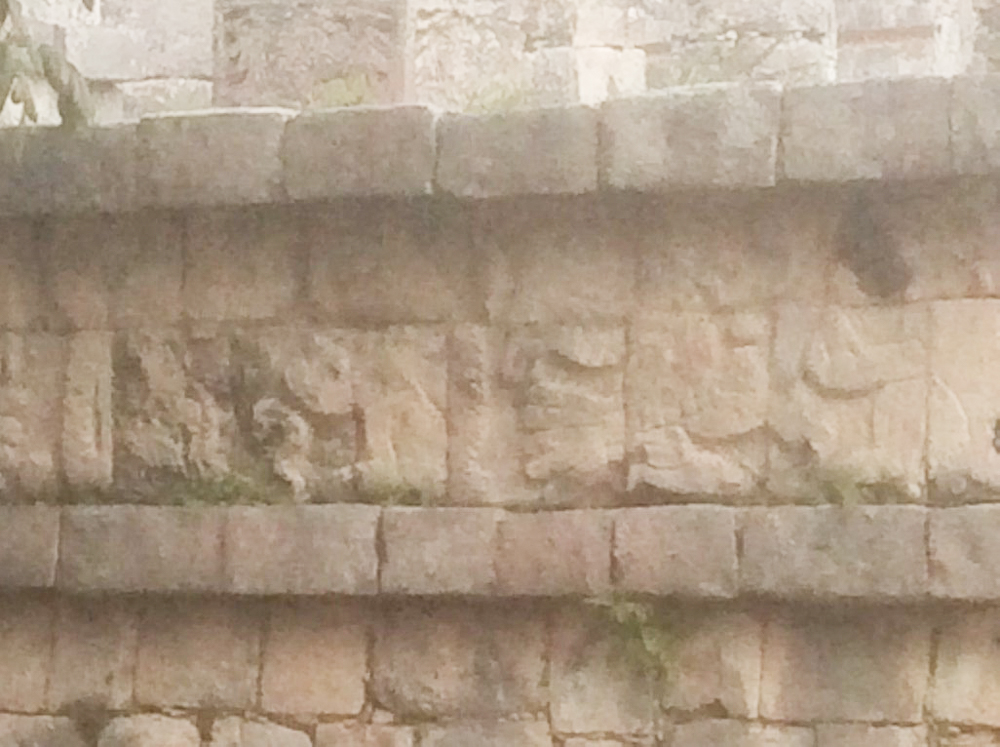
Ballplayers are featured against the walls of the ball court. The walls are 8 meters high, and set high up in the centre of each of the walls are rings wings with intertwined serpents.
The Mayan rain god...Chac
A plumed warrior and a snake...
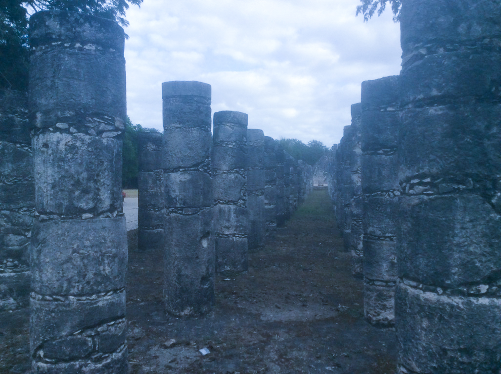
Part of the Temple of the Warriors. These columns would have supported a huge roof structure.
Can you imagine playing the Mayan ballgame in this court, playing for your life?
In one of the panels in the ballcourt, one of the players has been decapitated; the wound emits streams of blood in the form of wriggling snakes.
I am afraid I was at Chichen Itza at the wrong time in order to view the descending serpent, but nevertheless, the stairway to the temple is magnificent.
More warriors
I think that I can see an Eagle and some snakes.
A Wall of Skulls..
Can you imagine trying to place a ball through that ring, not using your hands and only utilizing your feet and hips? Playing for keeps.
The Temple of a Thousand Warriors.
Entryway to the Ballcourt..
The light changes throughout the day contribute to Kukulcan pyramid's changing personality.
A huge serpent frieze...
I remember my son Ian standing amongst the Temple of the Warriors when we visited here.
Another view of the ballcourt, showing the immense size compared to the players who would struggle to get the balls in the rings, high on the walls.
Every where one looks, the feathered Serpent is watching
To be successful in the ballcourt, the leather-bound rubber ball needed to go through the ring..or else.


It is particularly challenging to catch the carvings in the best light in order to capture the intricacies of the designs. It is worth remembering that these figures are literally carved in stone and thousands of years old.
It is important to note that there are significant Mayan sites very close to these features, which draw the majority of the tourists. For example, the Yucatan peninsula is a limestone plain, with no rivers or streams. The region is pockmarked with natural sinkholes, called Cenotes. One of the most impressive is the Cenote Sagrado, which is 60 meters in diameter and surrounded by sheer cliffs that drop to the water table some 30 meters below. Archaeologists have removed thousands of objects from the bottom of the Cenote Sagrado, including material such as gold, carved jade, copal, pottery, flint, obsidian, and skeletons of children and men.
About 4 km. south east of Chichen Itza there are a network of sacred caves known as the Cave of Balankanche. A large selection of ancient pottery and idols may be seen still in the positions where they were left in pre-Columbian times.
For my next visit to Chichen Itza, the Cenote and the Cave of Balankanche are on my list.
UXMAL
While Uxmal is very near the tourist city of Merida, I did not detect the tourist traffic flow which was very evident in Chichen Itza. Again, I was interested in the architecture, the glyphs, and the subtle differences between the Mayan sites.
I did not recall seeing the arch developed in the other sites which I had visited.
Some of the reconstruction efforts are visible to the curious. Some of the blocks below have been numbered and labelled. Can you imagine the time, effort, and concentration required to put these puzzles back together again. I am forever grateful for those folks who have the patience and skills to be reconstruction archaeologists and engineers.
Look at this arch. This in not a simple task of laying a few blocks together and making a door, but a serious construction challenge.
I was impressed with the number, quality and preservation of the glyphs at Uxmal. It seems that the builders were very artistic and determined to record the history of their period.
A Pan shot of the interior of the complex..
The entryway into the main plaza is spectacular.
The reoccurring theme of the Plumed Snake appears again and again.
The work on these faces was incredible to scan. Each view presents a different story.
Chaac Mol, the Mayan rain God. Apparently, when Queen Elizabeth visiting in 1975 for the inauguration of the site's sound and light show, and when the system played the Maya prayer to Chaac, a sudden torrential downpour occurred. Perhaps Chaac is not a Monarchist.
EK Balam
For me, there is no doubt that the Jaquar Altar at Ek Balam was the highlight of the visit.
The quality of the carvings was exquisite. I could not get enough of the symbols surrounding the dark entryway.
From this structure, you can see across the wide plains of the peninsula. Apparently, one can see Chichen Itza, which is 55 kilometres away from this site.
The artifacts are in such pristine shape and appear to be "brand new" because the complex itself was still under a mound of earth and rubble, as recently as 1998. Again, the scientists and archaeologists have brought back to life a precious record of the Mayan culture.
The defensive walls built at Ek'Balam are of considerable height and strength, designed to defend the complex from intruders.
There is a feature in the middle of this shot. It may be Chichen Itza, or perhaps Coba, which apparently can be seen as well.
I marvelled at the detail: little rocks filling in the gaps between the bigger stones.
Wonderful trees...
I wonder what lays beneath is mound of rubble? Perhaps my grandkids will visit and discover yet another temple.
A huge mound, hiding another temple perhaps?
Just another Bimbo in Paradise..
Another ballcourt, not as large as Chichen Itza, but huge nonetheless.
As mentioned, these magnificent artifacts were buried underneath a pile of rubble prior to 1998.
The stairs to the Temple of the Jaguar were not for the folks fearful of heights. Thank God nobody has fallen yet, otherwise the authorities will probably have to close this spectacular view.
PALENQUE
Dear Reader, yes all one of you,
I have some good news, and some bad news. The bad news is that most of my photos of Palenque are sitting in a program in my computer, looking at me and daring me to capture them. So far, Lightroom is winning, and I can't seem to get them to migrate to be developed and put onto the blog. The good news means that we are just about at the end of this posting....
Palengque is an excellent site to visit, with many new and interesting aspects of the Mayan Story.
This stelae is an example of the quality of the preservation that the site offers;
Again, I wonder what kind of wood was used to create the lintels on this doorway?
Sigh...Palenque photos are lost in cyberspace....Except for these:
Not being one to follow the pathways, I somehow got turned away from the main complex at Palenque, and ended up following the water source for the huge complex. There were pools and beautiful quiet little nooks, away from the main site.
I don't know whether I was expecting Howler monkeys or Bathing Maidens...but it was an truly out-of-the way site. The fact that Palenque had such a promising supply of water made it different than the other sites that I had visited.
Somehow, somewhere inside my computer the rest of the Palenque site reside. Perhaps someday my grandson(s) will help me find them. Another plan would be to revisit Palenque with a fool proof? camera.
I had accomplished my goals, in terms of visiting major Mayan sites. I was ready to head northward and see what Life would bring me, and it was not long before Life's Teacher began to work on me.
I was travelling through the state of Chiapas when I ran into this roadblock. The fellows wanted some money. I wasn't sure why, but I saw that the roadblock was there, including the spiked belt on the road. I did not quibble in this case, and handed over the 10 pesos, and thought that perhaps I was in Zapatista country, trying to put their politics into some form of understanding. Nevertheless, I paid the 10 pesos and got on the road..the very winding roads of Chiapas.


Sure enough, a little later on, I came upon this sign. Aha, I said to myself, at least I paid attention to the news, although Zapatistas are very old news for this part of Mexico.
Riding through this part of Chiapas was very challenging, in that the roads are narrow and continually climbing, not to mention more than their fair share of blind corners and steep drop offs as the mountains grow.
I ran into two sets of kids holding vines across the road, imitating what I assumed they had seen the adults doing, in an attempt to extort money. Both times, I was travelling at speed and blew through the kids' roadblocks. Thinking back, I could have stopped and yelled at them, but they would not have understood that their "playing" was bringing back some very bad memories of wrecking a bike with halibut line, less than a year ago. These two incidents with the kids preoccupied me as I climbed up from the lowlands into the mountains west of Palenque.
Tired, hungry, and probably a bit thirsty, I came upon another blockade. This time it was manned by close to 500 people, and it was close to an entryway to a small city, where I needed fuel. For some stupid reason, my alligator brain took over the conversation. They were demanding 50 pesos in order to let me pass. I was demanding to know why they thought they could close a public road and rip off tourists. I could see the municipal police way back in the crowd, not doing anything but leaning against his vehicle. I began to tell the leaders of the groups what I thought, and how f"ing stupid their actions were. Fortunately for me, they were used to dumb and ignorant gringoes who bitched over 50 pesos, and they let me rant for awhile. Part of me was thinking, as I was ranting, that these folks are pretty cool and they are holding the line, in spite of my bluster. Needless to say, I eventually came to my senses, and I found 50 whole pesos to give them. They in-turn, gave me a piece of paper which explained that they were pissed off at Coca-Cola, the local employer that was ripping them off.
A few days later, my Guardian Angles decided that my bad behaviour and poor manners deserved a lesson in Kharma. I was sitting in a cafe having lunch and left, without gathering my IPAD and notebook. 200 Kilometres later, I realized that I had left my bag and had to back track. Sure enough, the waiter had kept the bag and was glad to hand it over to the old gringo. Still unsatisfied with my insensitive behaviour, the Guardian Angles pulled the same trick again, a day later. This time I was far too north to return to the gas station where I had left my IPAD. Although the ladies initially tried to contact and work with me via telephone, they soon became tired of my Spanglish, and who knows who is enjoying my photos at this point?
Just to nail the lesson down, the Guardian Angels did a number on my camera around this time too. My return ride to the west coast, a quick revisit to La Manzanilla, the ferry ride to La Paz and the ride up Baja are simply memories in my photo brain...thanks for the read.


 I spent a lot of time and money aligning the brown stain with the workshop...I am hoping to keep the trend with the new paint scheme, whatever it is...


